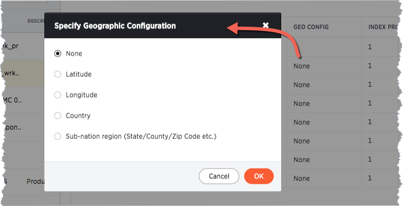
Certain attribute columns that contain location data can be used to create GeoMaps. ThoughtSpot supports Latitude, Longitude, Zip Code, US States, US Counties, Countries, and select international sub-nation regions.
You can designate a column as Geo by editing the GEO CONFIG column in the
table Columns page. You cannot edit the geo configuration column information
in the model.xls file.
Guidelines for geographic columns
Columns that can be designated as Geo columns need to contain text (VARCHAR)
data unless they contain latitude/longitude data. Latitude and longitude columns
can contain numeric data (DOUBLE) or text.
If you are using a column with the data type DOUBLE for latitude and
longitude, you will also need to change the following settings for those
columns:
- set Column Type to
ATTRIBUTE - set Additive to
NO - set Aggregation Type to
NONE
For information these settings, see Set ADDITIVE or AGGREGATION.
How to edit geographic columns
- Find the GEO CONFIG for the column that contains the geographical data.
-
Select the column to display the Specify Geographic Configuration dialog.

-
Change the value to the appropriate GEO CONFIG, depending on the kind of geo data the column contains.
If your data includes latitude and/or longitude columns that are stored as a numeric data type (
DOUBLE), make these changes for those columns:- Change the Type to
ATTRIBUTE. - Change ADDITIVE to
NO/FALSE.
- Change the Type to
- Save your changes.
List of geotypes
| GeoType | Description | Type: Example | |||||||||
|---|---|---|---|---|---|---|---|---|---|---|---|
COUNTRY_REGION |
Countries |
|
|||||||||
COUNTY |
Counties in the United States |
|
|||||||||
STATE_PROVINCE |
States in the United States |
|
|||||||||
LATITUDE |